Click on the above Google Map for Details of Route
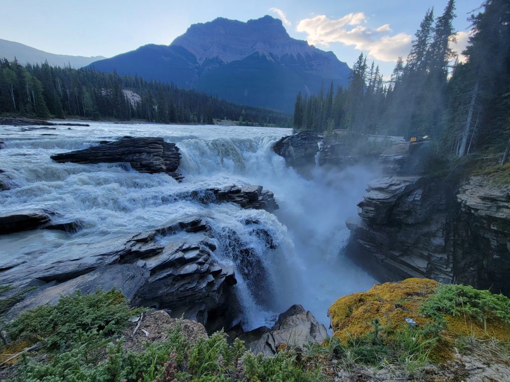
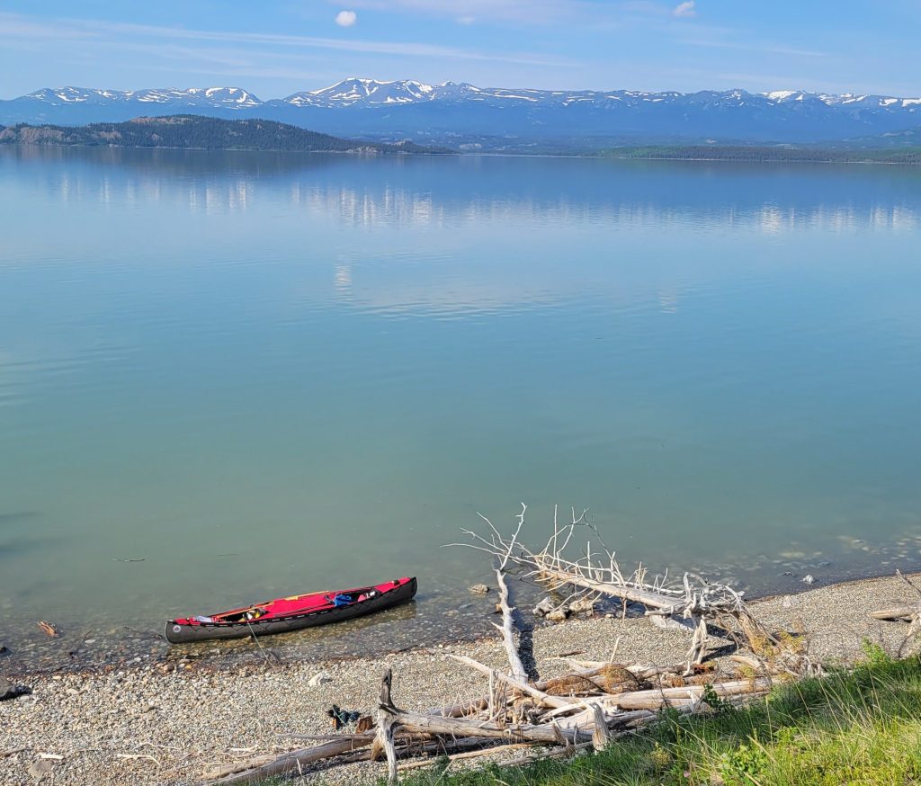
Jasper, nestled in the Rocky Mountains of Alberta, is where we will start a 2,000-kilometre canoe trip to the community of Hay River in the Northwest Territories. On May 12, 2024, we will launch our canoe into the Athabasca River and paddle northeast on the Athabasca and Slave Rivers to Great Slave Lake. Throughout our journey, we will paddle through numerous National and Provincial Parks, and, First Nations Reserves that protect the banks of these historic rivers. We enthusiastically anticipate our paddle through one of the world’s largest freshwater deltas – the Peace-Athabasca, and, Canada’s largest National Park – Wood Buffalo National Park.
Depending on the speed of the water flow and barring any natural weather occurrences, we hope to complete the trip in approximately 6 to 8 weeks.
One of the most interesting paddles of 2023 and one of the most challenging was our journey into Woodland Caribou Provincial Park in North Western Ontario. Interesting, due to the rich diversity of a vast protected area that had recently been recognized as a World Heritage Site for its boreal and cultural ecosystem. Challenging, because of frequent forest fires that have changed the landscape considerably. The most recent was in 2021 when approximately 55% of Woodland Caribou Provincial Park burned due to natural forest fires. The park is no stranger to forest fires – fire is key for regeneration in the boreal forest.
Upon arrival at the park, we discovered that some areas of our pre-planned route were not passable. It takes years for park staff to cleanup after a burn and many areas of the park’s portages had not been cleared yet by maintenance crews. After gathering advice and knowledge from a local outfitter and park staff, we soon came up with a new plan. With our new route established, and the canoe strapped to the float of a Beaver, along with 120 pounds worth of gear on board, our bush pilot flew us to Lower Artery Lake in Manitoba. From Artery Lake we headed east on the Bloodvein River, a Canadian Heritage River System towards Larus and Murdock Lakes. The Bloodvein has been traveled for thousands of years by the Anishinaabe people who had a deep relationship with the land. To this day, their descendants are working to rebuild and nurture this relationship.
As we travel by canoe through Woodland Caribou’s endless network of clear lakes and sparkling rivers one can’t help but feel a connection to the land. We are surrounded by the rich diversity of full-grown boreal forests to forests regenerating in various stages of growth. Its unique water-rich, prairie-boreal landscape makes it different from anywhere else in Ontario that we have paddled. This is a wilderness area where the climate is affected by prairie winds from the west and cold air from James Bay. Once again, the wind was our nemesis, however, thankfully this area was one of the only parks not affected by forest fires and smoke that was raging all across Canada in 2023.
The Bloodvein River
On the way from Royd Lake to Gammon Lake we spotted a caribou waking up from a nap along the shoreline. We were so fortunate to see this elusive creature as it arose, shook itself awake, checked us out, and sauntered off into the forest. Boreal Woodland Caribou, cousins of the European Reindeer, make their home in the boreal forests where forest fires are the main type of disturbance.
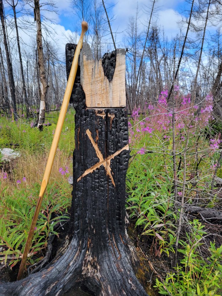
Bushsites and portages are at times difficult to find in areas of extensive charring caused by fires, but we always manage to persevere. At times we appear to take portages where portages do not exist but should exist, yet other times we are thankful that others have blazed axe markings on remaining stumps of burned trees to show the way. Somewhere along the way to Hansen Lake our Garmin GPS decided to not show a large area of the terrain, it was all blank! Navigation at this point was by paper map and compass. We focused and studied the landscape carefully for fear of paddling into the wrong bay trying to locate already difficult-to-locate portages.
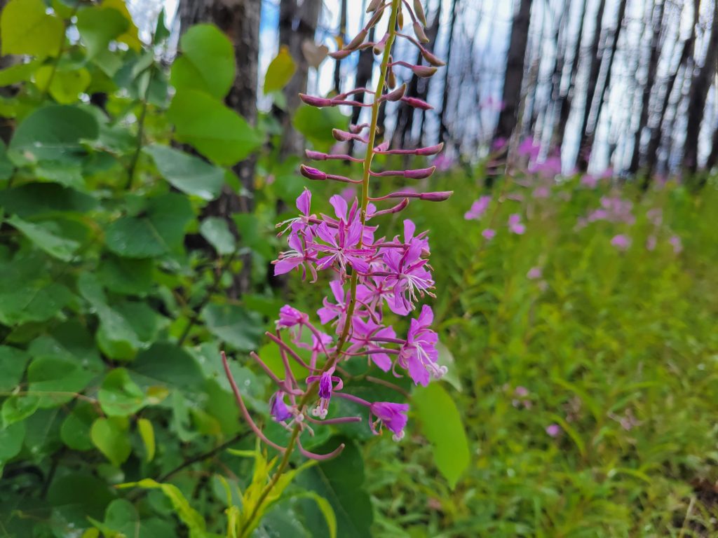
It is uniquely interesting paddling and portaging through burn areas affected by forest fires. As daunting as this may seem, it is incredibly beautiful to see the stark contrast of exposed rock where a forest once stood. Now life is growing again – brilliant fireweed is one of the first to appear. So pretty to see all that purple! Even though Woodland Caribou was a trip with obstacles and challenges, this was offset by the beauty of seeing a new-growth forest emerge. Nature demonstrates its brilliance with new foliage and the abundance of pollinators such as bees, busy at work regenerating the forests. The forest, charred and barren as it seemed, was alive with wildlife. With the lack of trees, we could view a greater distance into the landscape, where bears were active in search of berries, and where moose wandered the many streams and marshy areas feasting on marine vegetation.
We felt privileged to witness first-hand this beautiful large unspoiled wilderness that has been untouched by industrial development for thousands of years. Truly ‘The Land that Gives Life’.
We are very excited to be featured on WPBS Weekly: Inside the Stories! Watch the video by clicking on the photo!
WPBS Inside the Stories August 2, 2023 by Gail Paquette
“In Kingston a couple made it their mission to raise money as they traveled over 8,000 kilometers by canoe, championing policies affecting food security, poverty, social inclusion, and community health. They believe food is a basic need and should be treated as a human right. Meet Glenn Green and Carol VandenEngel and learn more about their mission, Canoe for Change.”
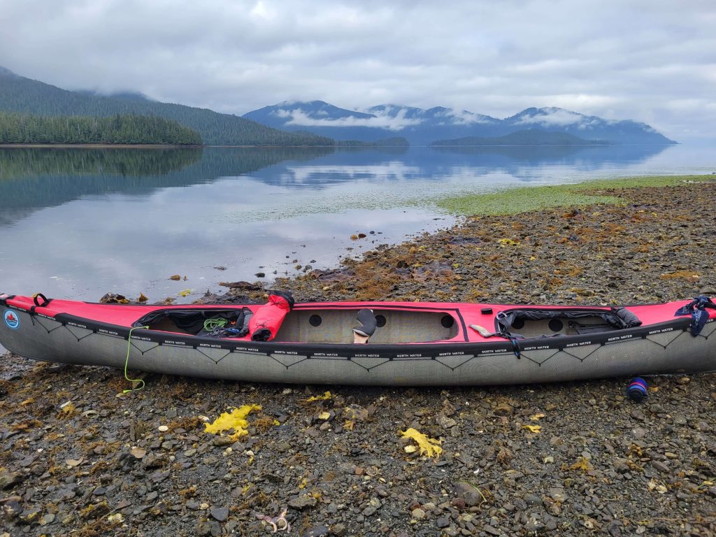
With our canoe and gear loaded into a large zodiac boat we were excited to start a two-week coastal adventure on an island in the Pacific called Haida Gwaii. We arranged for a shuttle of our canoe and gear to Rose Harbour at the southern end of the island. It is here we will begin our coastal adventure and paddle north. The morning sky was overcast as we both donned our personal rain gear as well as a heavy rain slicker the boat captain provided. The zodiac boat with its powerful twin outboard motors quickly maneuvered between the islands and inlets, with the hull bouncing up and down as it pounded the ocean swells. We both attempted to absorb the scenic shoreline along the coast during the four-hour journey as the mist and drizzle became more prevalent. It did not take long and the temperature and moisture chilled us both to the core!
Haida Gwaii, an archipelago of 150 rocky islands off British Columbia’s west coast, is home to dramatic landscapes, abundant wildlife and some of the world’s richest heritage with more than 500 archaeological sites. Formally known as the Queen Charlotte Islands, Haida Gwaii is the ancestral territory of the Haida Nation, only accessible by boat or plane, it is known as Canada’s ‘Galapagos’. A perfect place to continue our paddling adventure and explore more of this great country.
Before venturing into this magical sub-tropical rainforest, a half-day of mandatory education, registration and orientation must be completed. The southern section of Moresby Island is the Gwaii Haanas National Park Reserve, Marine Conservation Reserve and includes many Haida Heritage sites. This area is protected by both the Federal Government and the Haida Nation – from the sea floor to the mountain top. The Haida Nation signed the Gwaii Haanas Agreement which established the archipelago management board, which means the Federal Government and the Haida Nation work together to ensure the proper management, use and operation of the area. Registration for our trip and entry includes an action plan approval of emergency self-survival and rescue actions. This session was to ensure we were adequately prepared to be self-sufficient, and skilled in emergency situations, including equipment failure. The area has significant tidal variation, strong currents and strong winds that develop with little warning. Since we are not paddling with a group, the authorities want to ensure that individuals paddling this rugged coast have the skills required to survive many days if help is required. We also learned very few canoes make this trek, the preferred mode of travel is the sea kayak, and the training staff was intrigued by our choice.
Shuttle by Zodiac to the southern tip of Gwaii Haanas. The vessel was capable of carrying twelve individuals, their gear and several kayaks or canoes strapped to the top, yet we were the only ones on board.
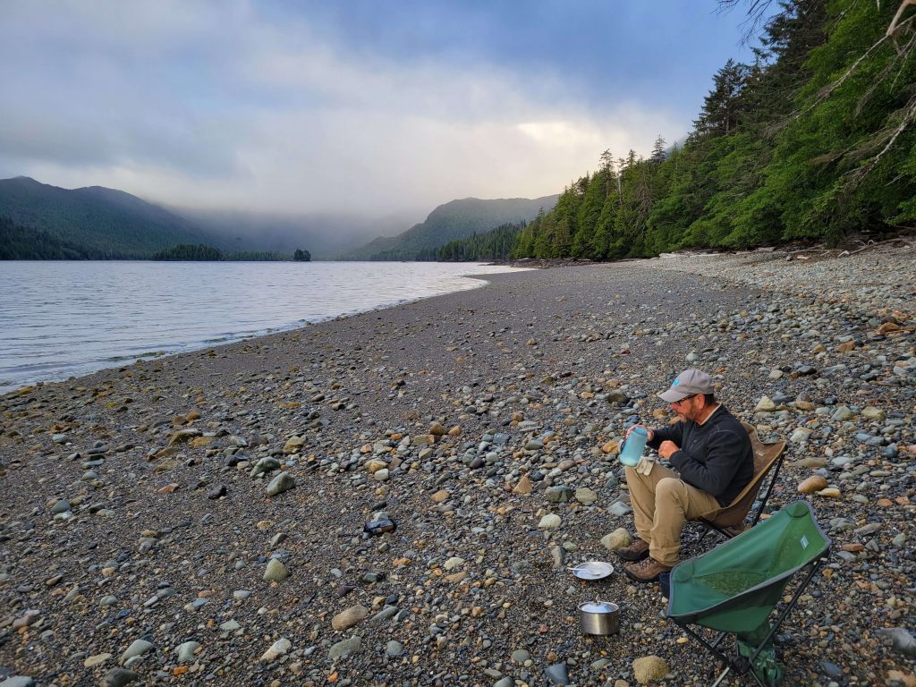
We eventually arrived at a large cobblestone beach; large because the tide was out exposing a large area of real estate. We gazed in wonder at the scene before us. The campsite was tucked nicely behind large pieces of driftwood beyond the high water mark. Behind the camp was a freshwater stream winding through the rainforest with thousand-year-old trees standing majestically in the background. We would spend the rest of the afternoon relaxing, sitting in our camp chairs and watching tiny Sitka Black-Tailed Deer leisurely stroll past. These creatures would approach and stare and move on as if we were entertainment for them. During the late afternoon seals would swim past, a large number of them, traveling if on a mission to reach a location where they could bellow and howl all night. Rest came easy for us this night. Perhaps it was the sea air that relaxed us along with the serene quiet of the forest that surrounded us.
Venturing up the coast we encounter stunning rugged coastlines and scenery that appeared to change with every turn. Mountains and spectacular sunrises filled the vistas. In deeper waters whales breached the surface creating large splashes with resounding thuds that reverberated over the surface of the water. When we stop each night, camp is carefully selected. Selection is above the high water mark, yet sheltered enough into the thick lush dense growth of ancient trees to shield us from potential stiff breezes coming off the ocean. We were warned not to wander too far into the old-growth forests during windy days for fear of huge moss-covered trees toppling over without advance warning.
The mystic wonders of Gwaii Haanas sub-tropical rainforest.
At camp ravens were curious and, we think territorially as they hopped along behind us as we walked along the cobble beaches, observing what we were up to. After being windbound on a particular campsite for several days, a raven observed that Glenn did dishes after each meal. The raven kept a watchful eye on Glenn as he would gather the dishes after each meal and proceeded to the ocean to clean up. The raven walked behind him down to the long shoreline. The bird stayed with him the entire time as he bent over to wash the dishes. Glenn engaged in a one-way conversation with the raven while the bird tilted its head as if understanding what was being said and then followed him back to camp. Carol was totally ignored.
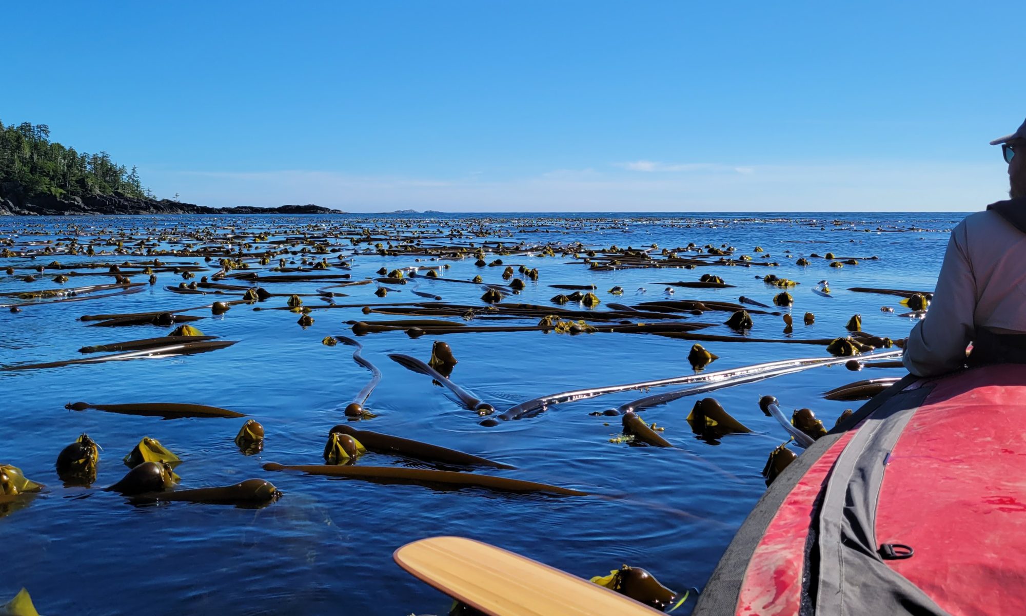
When we paddled close to shore at low tide many rocks were exposed. This exposure led to the discovery of amazing colourful starfish and sea urchins. Huge seabeds of kelp provided hiding places for playful seals which constantly circled our canoe. The seals would stick their heads as far out of the water as to get a good close look at us and size up the situation before slowly and almost in a sneaky way slithering below the surface. Then reappear and slap the water directly behind us, to startling effect.
Twice the wind and resulting wave action kept us grounded for several days at a time so we take the opportunity to do some shoreline exploring. Other times we ventured with the canoe into long sheltered inlet bays and coves, whereupon chance Carol found ancient headstones marking old graves. We did not wish to disturb this sacred place, but did make note of its location on our map and later reported to the authorities who gave us our orientation session.
Kelp was plentiful in the area and once dried, a delicacy for Sitka Deer.One of many beautiful designated campsites.
The last campsite we stayed at was across a large bay from a Haida Heritage site called Gandla’kin (Hot Spring Islands) with three spring-fed natural hot tubs carved into volcanic rock. During our previous orientation session, we were educated on the etiquette of asking permission before approaching and landing at a Haida Heritage site using a two-way radio. The Haida sites are guarded by the Watchmen, elders of the Haida Nation, who ensure the land is respected and the visitation impact is minimal. They educate visitors regarding the animals and mammals of the area. How the Haida Nation reveres these creatures through stories, passed down from generation to generation. These creatures’ spiritual beings are held in high esteem by being carved into cultural totem pole figures.
Loading gear and preparing for a day of paddling. Yikes that water is cold!Watching the tide go out during an early morning breakfast.
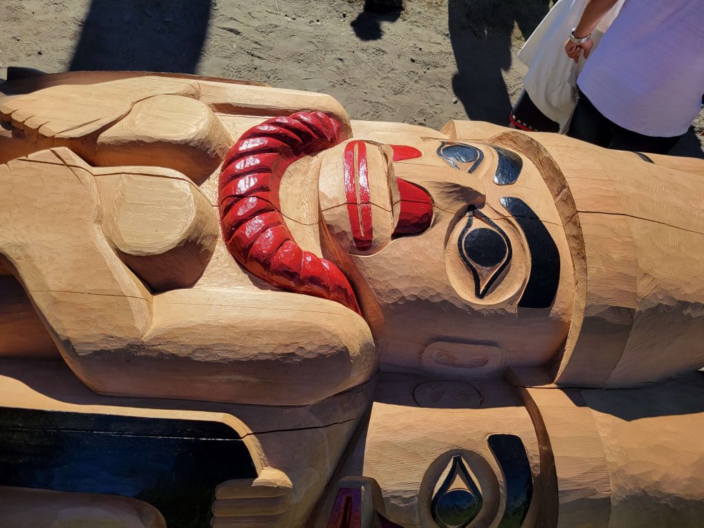
With our two-week paddle in Gwaii Haanas now complete, our last week on Haida Gwaii was spent doing day hikes and exploring the beautiful island. We heard through the grapevine that there was to be a pole-raising ceremony at Old Masset. Haida master carver Christian White, the carver of the totem pole turned a western red cedar log, estimated to be somewhere between 800-1000 years old, into one of Haida Gwaii’s largest totem poles at 53 feet. The pole depicts the killer whale, the moon, raven, amoung others and is surmounted by three watchmen, and was raised as a tribute to the “living Haida”. This was indeed a special event! It turned out we were more than casual spectators. The event was a grand celebration with First Nations peoples meticulously dressed in their colourful traditional clothes.
After numerous hours of feasting, celebrating and observing the finishing touches being carefully applied to the creation, the pole was blessed. It was time to raise the pole. Volunteers were sought and requested to man the many ropes to lift the huge piece of art into place. Glenn quickly jumped at the opportunity, and along with tens of dozens of other abled bodies, pulled and tugged on the ropes as it was guided into its final resting place. Everyone worked in harmony as the crowd around the base of the pole broke into a festive song. This was a remarkable sight to behold.
Our three weeks on the islands were an adventure and a rewarding experience. Haida Gwaii is an astonishing place, rich in culture, and fascinating wildlife and a place unique as the inhabitants who live there. Truly the Galapagos of the north.
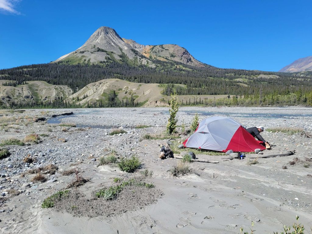
Aerial view of the Slims River in Kluane National Park, Yukon Territory.
Kluane National Park is a vast wilderness of ice fields, forests and towering mountain peaks. After spending two weeks paddling the Yukon River, a multi-day hike was in order to take us into the interior of the park. Kluane is home to Canada’s highest peak, Mount Logan at 5,959 meters, contains the world’s largest non-polar ice field and has a diverse grizzly bear population.
Our sights are focused on the Slims River Trail West (Ä’äy Chù). We registered at the park office and completed the mandatory wilderness permit process. Questions such as what is your wilderness survival experience? Did we have or would we need a certified national park food bear container? What type of water purifier did we have? What was our emergency backup? All very important to the park staff to distinguish well-prepared hikers from tourists. Upon our return, special emphasis was to perform deregistration and to report all bear sightings including date, time and location. We were approved and issued a pass to venture into the Slims River Trail and were told there is no cell phone coverage and no search parties, should we get lost. Our trip plan is simple. The trail is a 45 kilometres return hike. We were going to hike to an established camp at the 22.5-kilometre point, spend the night and hike to Observation Mountain, a viewing plateau for a glimpse of Kaskawulsh Glacier, the next day. We would return to our camp and spend another night, then we would go back along the same route from whence we came.
We both were excited and well-rested when starting out early in the morning of July 19, 2022. The trail is mostly unmarked, only recognizable by cairns that have been erected by previous hikers. After about three kilometres into the hike, the trail departs from the mining road and we had to undertake our first stream crossing at Sheep Creek. It was to be the easiest crossing of several to be circumvented along the trail.
Easy crossing at Sheep Creek!
At the 5.8 kilometre mark, we came to Bullion Creek which is faster and deeper. Alluvial fans made creek crossings a multi-crossing task as the volume of water in the streams depends on the weather, the season and the time of day. Early morning has less volume; late afternoon, after a day of sun-melt snow, has more. Caution needs to be exercised when crossing creeks. The best way to tackle crossing each creek is to wade into the fridged cold waters facing the current as a pair, your partner holds your hips or backpack from behind and the person in front uses hiking poles. Both walk sideways carefully in tandem to the other side. This gives you both stability and support against the strong current. We removed our hiking boots to keep them dry and slipped on our heavy-soled sandals and shuffled across the numbing cold waters to reach the other side using our buddy system.
Getting ready to do a multiple crossing across the braided tributaries of the alluvial fan. Fans are created when fast-moving mountain streams empty out onto a flat plane.
Past Bullion Creek we came across a large expanse of sand dunes with colourful, highly mineralized mountains towering behind. After the dunes, the trail goes through an area of dry salt flats, where the mud is covered with a crust of white minerals. All very strangely beautiful and new in this vast land of wilderness.
Bullion Sand Dunes.
Just after the half way point to our destination, we came across a mother grizzly and her cub. We saw her first before she saw us, and together we shouted to give warnings that we were near. The mother grizzly stood up on her hind legs arched her neck and extended her nose to get a better sense of us. We realized then how much larger a grizzly bear was compared to a black bear. The bear and her cub then proceeded to head off down the same trail we needed to go. Nervous as we were, we thought the best strategy was to circumvent the trail and walk along the river bank until it was safe to get back on the trail. With our bear spray in hand, we sang and spoke loudly approaching every turn and blind hill on the trail, making ourselves known.
After approximately ten hours of hiking including lots of rest to enjoy the views and the diversion off-trail, we eventually reached the camp. The last two kilometers were the most challenging as the terrain became steeper and very narrow. We reached the camp and found it had a designated cooking and food storage area that is several dozen meters away from the assigned areas to erect tents. We obtained our drinking water from the stream near the campground which was running clear. Those wishing to use this as a day camp, do so to explore the area. Others may rest, spend the night and hike out the following day.
View from our camp.
On day two, we decided to hike to Observation Mountain with the intention of getting a view of Kaskawulsh Glacier. This day we woke up to clouds but decided to venture out anyway knowing the view could possibly be impeded by clouds, rain and fog.
There is no maintained trail to the summit so the day would involve some route searching. Fellow hikers from camp pointed us in the right direction and off we went with our GPS. We crossed Canada Creek, hiked up the canyon towards Columbia Creek, and finally followed a narrow and steep game trail carved out on the edge of the long hill. The ledge dropped off to the river below. The sights here were remarkable. It was one of the steepest climbs we have ever experienced. Pausing momentarily was the best way to take a breath and enjoy the river and distant hills below. Unfortunately, cloud cover over the summit did not permit us the visual presentation we had hoped for. Turning back, disappointed at not reaching our destination, we pacified ourselves by deciding to fly over the glacier on a local air tour upon our return.
Looking back towards the Slim’s River with Columbia Creek in the valley below.View of Columbia Creek from the hiking trail going to Observation Mountain.
After a restful night’s sleep and a hearty breakfast of oatmeal and coffee, we left early to venture back 22.5 kilometres to the trailhead. The scenery always looks different when traveling in the opposite direction and we noticed things we did see on our trip coming in. We gazed at the snow-capped mountains ahead of us on the opposite of the river. We paid more attention to the river and the way the sunlight seems to illuminate the surface. We noticed human footprints along the bank of the river. It would appear others had hiked along the flat river bank surface to avoid the hilly rocky terrain along the river. We decided to take this alternate path allowing us to have a wide-open view of our surroundings as well as to avoid any surprise future grizzly encounters.
According to local legend, the English name of the river “Slims” refers to a horse that sank and was killed in dangerous “Quick Mud” along the river banks. We kept this in mind walking on the firm drier surface following the footsteps of the others and avoiding the bubbling sandy wet areas. From our orientation given by the park staff, we learned the riverside is a travel corridor for wildlife which was evident by the number of tracks witnessed in the mud. Bear prints, wolves, and a multitude of birds had left their impressions behind. The travel along the river would not take us all the way back to the trailhead so we had to leave the river and head inland to search for cairns again.
With the warmth of the afternoon sun, we were concerned with the volume of water at our crossing at Buillon Creek. When we did arrive at the creek late in the day our concerns were valid. The volume of water was high including a fast current flowing down each tributary. Experience has shown accidents happen with fatigue and exhaustion and after walking close to sixteen kilometres we were not as energetic as we were when we first started. The crossing would mean many multiple times removing our boots to cross the extended alluvial fan. Rather than risk disaster the decision was reached to camp on the shore and cross in low morning volume. This was a decision we did not reach easily. We weighed the pros and cons. First, we were alone in grizzly territory, but the expanse of the alluvial fan gave us great visibility to witness any approaching animals. Second, the wind had picked up and was blowing sand and silt from the surrounding hills which made securing and anchoring the tent difficult on the smooth rock-strewn surface. But there were lots of larger stones to weigh down the tent corners. We spent a restless night with the noise of blowing wind, fine silt collecting in our tent and alert to the possibility of large animals approaching.
Quick mud!Lots of rocks around to secure our tent at Buillon Creek!
At daybreak, the winds had ceased and we crossed the creek with little effort. Once back on the trail we observed fresh bear tracks in the soft earth and started to sing verses of songs to create noise. When we deregistered at the park office, we reported the bear sighting. They told us that because four other parties of hikers had encountered and also reported bears, the park would shut down the trail for several weeks to future hikers. The park must follow certain formula criteria to protect the bear’s exposure to humans: hikers versus bears versus hours in a given time frame. We felt guilty that this closure happened, but understood, after all, we are in the animal’s backyard. The well-being of the bear is a priority in Kluane.
In conclusion, it was an excellent hiking trip into the backcountry of a Canadian national park! We would recommend it to anyone that wants to avoid the crowds of Jasper and Banff further south in British Columbia. Even though there were many challenges the scenery was uniquely beautiful and the experience is one we will never forget.
Aerial view of Canada Creek, Observation Mountain and Kaskawulsh Glacier beyond. The mighty Kaskawulsh Glacier! Seen on a bright clear day from our Glacier Air Tour!Slim's River Trail Map
Yukon River as seen from viewpoint above Dawson City.
It has always been on our list to drive across this vast country to the northwestern reaches of Canada. It came to fruition in May 2022 as we set out for the Yukon Territory with the intent of exploring northern British Columbia also. And explore we did! We drove through breathtaking regions and experienced awe-inspiring moments. In total, we were away for fifteen weeks, two of which were spent paddling on the Yukon River.
After researching various flatwater canoe routes, it was decided to paddle a portion of one of the major watercourses of North America, the Yukon River. Termed the ‘great river’ in Gwich’in, it is 3,190 kilometres in length flowing from the source of northwestern British Columbia, through the Yukon Territory, into Alaska until finally emptying into the Bering Sea.
During trip preparation, we established contact with Mark of Up North Adventures, an outfitter in Whitehorse. Arrangements were made to store our canoe and gear in Whitehorse while we continued to drive northward to Dawson City. We would then fly back to Whitehorse and paddle back to Dawson City to retrieve our car two to three weeks later. We initially intended to start from the source of the Big Salmon River at Quiet Lake. Quiet Lake flows into the Big Salmon River and then continues north to merge with the Yukon River 255 kilometres later. However, our arrival in Whitehorse alerted us to be flexible and relaxed as situations arose that were not within our control. When we arrived, Mark informed us that our arranged shuttle to Quiet Lake (the start of our journey) would not be possible. After a record-breaking accumulation of snowfall in the mountains and a late spring melt, the bridge connecting the access road to Quiet Lake had washed away due to excessive flooding. We gathered around a large lamented map fastened on the wall in Mark’s office to study an alternate route. After much deliberation, we decided to start from Whitehorse and paddle the ionic Yukon River 715 kilometres to Dawson City. While waiting for the high waters to recede, we decided to delay our canoe trip for two weeks and explore Tombstone Territorial Park near Dawson City.
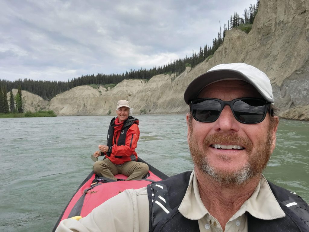
Arriving back in Whitehorse after several weeks, we were eager to start our paddling adventure! Although the water levels were still high and the current strong we felt confident in our ability to navigate the challenges of the river. The Yukon can be paddled by those with a basic skill level, however, with the water flow running swift, good paddling skills are necessary. (The challenge lies with maneuvering the canoe safely to the shoreline in a swift current and departing when leaving land.) With our trusted 16-½ foot carbon kevlar canoe and our gear stowed securely underneath the splash deck, we set out to explore this historic river.
After a late start, our first night’s camp was spent on an island just outside of Whitehorse. The following day we proceeded to Lake Lebarge, which is basically a fifty-kilometre widening of the Yukon River. Normally a windy lake we were greeted with warm temperatures, bright sunny skies, and glassy calm waters. Surrounded by the jutting points of mountain peaks, it has miles of beaches, and numerous bays and is one of the many splendors of the Yukon. On one of those bays is where we set up camp. We retired around nine that night and were alarmed when we woke several hours later by barking and howling. Out of the tent, we arose unnerved by the close proximity of what we presumed to be a large pack of timber wolves signaling their presence. Still very much daylight under the midnight sun, we built a large campfire, not so much for protection from the wolves as they usually avoid us humans, but simply for our own peace of mind. We surmised there was either an event that was happening within the pack itself or they did not like our presence. The wolves howled all through the night and into the next morning. We wearily paddled away from lack of a good night’s sleep.
East Shore of Lake Lebarge.
Exiting Lake Lebarge, the Yukon turned and twisted while the current increased significantly with the narrowing of the river. The river north of Lake Lebarge flows through a broad, generally flat-bottomed valley with scenic white cliffs. The river meanders across the valley floor with numerous sandbars and small islands dotting the channel. With the water levels still very much above normal, we were always on the lookout for high ground – clearings where we could camp or remove ourselves from the canoe to stretch. While moving with such a strong current, campsites are often hard to spot and difficult to access. Often we would zip right past a site with no chance to correct and paddle back against the current, so it was on to the next one, hoping for better success. When we did manage to find a spot it was always a challenge to reach. The river banks were steep and slippery, as the swift-moving water constantly eroded the earth. We had to scramble up these muddy steep embankments, using bushes or exposed tree roots as hand grips. Once on land, we had only a few minutes of peace before the wrath of millions of mosquitoes found us. We made quick work of setting up our large bug shelter to have some reprieve from the mosquitoes that were small, quick, and ferocious!
One of several large group campsites that were flooded by high water levels. Yukon River north of Lake LeBarge.
The Yukon River is rich in history. Gold was discovered in the Klondike in 1886 setting off a stampede of tens of thousands into the gold-laden creeks near Dawson City. With the influx of people, trade and commerce increased and steamboats travelled the river bringing in supplies and people. We saw relics of lumber mills that were established along the river to provide fuel for the steamers. We saw the skeletal remains of a steamer and trapper’s cabins and read stories of the people that were caught up in the stampede of the gold rush. We followed our map and marvelled at the names of “Keno Bend”, “Shirt Waist Bend” or “Carpenter’s Sough”, all depicting some event in time or tragedy.
Paddling past where the Big Salmon River enters the Yukon River, we thought about what we would have missed had we taken that route. Our daydreaming quickly dissipated as we concentrated on approaching Five Finger Rapids. We had previously scouted out the rapids on our way to Dawson City. There is a hike from the highway that goes to a spectacular viewing platform giving us an idea of what we were up against. The rapids are named for the five channels or fingers that pass through four basalt columns. The right finger is where a paddler must aim the bow to ensure safe passage. We remained nervously silent as both of us listened to the thunderous volume of water passing amongst the series of steep islands carved out of rock. It would not bide well to capsize in the frigid cold waters of the Yukon River. With nervous anticipation, we chose our line of travel and headed toward the right channel. With the current picking up speed quickly, we dug in our paddles keeping a wary eye on the four-foot-high haystacks at the bottom. Staying slightly to the left of the haystacks, we breathed a sigh of relief once we were in the clear. We looked back in awe at the quick and exciting moment of tackling this rapid, one that we normally would never have the nerve to attempt.
Five Finger Rapids from a viewpoint above Yukon River – Carmacks.
While paddling down the watery trail of the Yukon River, we admired the endless wilderness surrounding us. The territory, a mostly semi-arid region of Canada, is sunny and dry. Black spruce, white spruce, and birch forests lined the tops of the banks with endless boreal forests beyond; home to hundreds of animal species and birds. When we were not on the water we hiked in the hills and took pleasure in the abundance of flowering plants. And, beneath the surface of the water, we acknowledged the waterway hosts some of the longest upstream migrating chinook salmon in the world. Salmon will migrate over 2,960 kilometres in freshwater from the Bering Sea to reach their spawning grounds as far as northern British Columbia.
When we approached Fort Selkirk for a planned stop, a forest fire was burning in the mountains of the Pelly River across from the fort. Here the Pelly River merges with the Yukon River and the area is rich in natural resources. The fort is a Heritage Site with preserved exhibits and buildings and is set in a pristine river valley surrounded by mountains. Fort Selkirk has been a trading post for the Hudson Bay Company, and before them, served the Northern Tutchone people as a traditional harvesting and gathering site for thousands of years. With the hazard of forest fires looming, we did not stay long at the fort for fear of getting trapped in what could become a serious threat. When we set off, the rest of the day was spent paddling furiously eager to pass the other four forest fires that were burning high in the hills. Little did we know at the time, we would be paddling in smoke for the remainder of our canoe trip.
Forest fire burning near Fort Selkirk.
The clarity of the Yukon River changed once we met the merger of the White River. The White River is glacier-fed and contains large amounts of suspended sediment from volcanic ash deposits. The ash deposit was formed by two large explosive eruptions that occurred around 850 AD. The Yukon river remained sediment laden from the confluence to its mouth. The sediment was evident in appearance and in sound, as we could hear the particles pinging off the bottom of our canoe. This change in the water condition led us to find small streams from which to source our drinking water.
The White River after merging with the Yukon.Trees, shrubs and debris washed away from flooded shorelines and islands along the Yukon River.
After paddling for two weeks on the Yukon River we arrived in Dawson City, travelling that last day 140 kilometres to our destination. It only took a mere ten hours to complete – a record day with record swift water pushing us along. Reaching our destination, we felt a sense of accomplishment, grateful to have paddled such a beautiful heritage highway. ‘Larger than Life’ is the motto of the Yukon Territory and larger than life it is indeed!
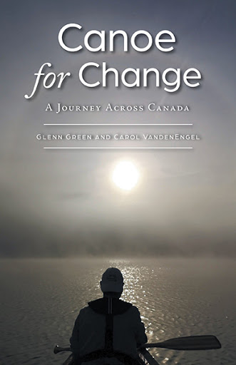
We published a book called ‘Canoe for Change: A Journey Across Canada’. Read about our canoe trip across Canada that took us from Vancouver, British Columbia on the Pacific Ocean cross-country to Sydney, Nova Scotia on the Atlantic Ocean!
The departure date for our long-awaited trip to the Yukon is finally here and we are off! Rather than paddling across Canada, this time, we will drive to the far reaches of our country, into the Yukon Territory of northern Canada, taking our canoe with us. When we canoed across Canada, our desire was to return to the northwest to further explore this beautiful rugged corner of our world. We will embark on a canoe trip paddling the Big Salmon and Yukon Rivers. The route is approximately 750 kilometres long from Quiet Lake on the Big Salmon to Dawson City on the Yukon River. Under the midnight sun, we will be canoeing rivers bordered by the spectacular backdrop of rolling mountains, rugged wilderness and rich wildlife.
Once we finish this route, we will continue to explore the Yukon well known for its vast spaces, rivers, lakes and mountains. Next, we traverse the ‘Top of the World’ highway, over the border, to the United States to Alaska’s Denali National Park and Reserve to complete a multi-day backcountry hiking and camping trip through the alpine tundra, around snowy mountains and over glaciers.
A dream we hope to accomplish is to paddle the eastern Pacific coast of Haidi Gwaii (also known as the Queen Charlotte Islands). Haidi Gwaii is an archipelago off British Columbia’s west coast rich with wildlife, remote islands and temperate rainforests. Centuries-old totem poles stand in the remains of the Haida Nation villages as well as bountiful beaches, hidden rugged coves and trails to explore on this ancient island.
As always, during our explorations, we will be in search of places where solitude, tranquillity and adventure exist. Watch for updates on our adventures on Facebook and Instagram!
Click on the map for more details of our Big Salmon and Yukon Rivers canoe route!
A Spoonful of Love!
When we paddled across Canada, we raised funds and awareness for Loving Spoonful. Even though the upcoming canoe trip is not as ambitious as when we paddled from the Pacific to the Atlantic Oceans, our support for Loving Spoonful continues. Our logo ‘Canoe for Change’ is emblazed on our canoe and we carry it with pride! Pride because of the work that Loving Spoonful provides in our community to work towards food sovereignty.
We continue to raise funds and awareness for Loving Spoonful which works towards the right for all people across Canada to enjoy healthy and culturally appropriate food through ecologically sound and sustainable methods. If you are able to donate, you can do so by donating here!
Do you know that ‘Canoe for Change: A Journey Across Canada’ is available on Amazon and Indigo Chapters? A percentage of the proceeds also go to support the ongoing programs at Loving Spoonful! Follow this link to our website Canoe for Change.ca to get your copy now!
Welcome to our blog! You have received our blog because you are a subscriber, friend or supporter of Canoe for Change! Email us if you have any questions or comments. We would love to hear from you!
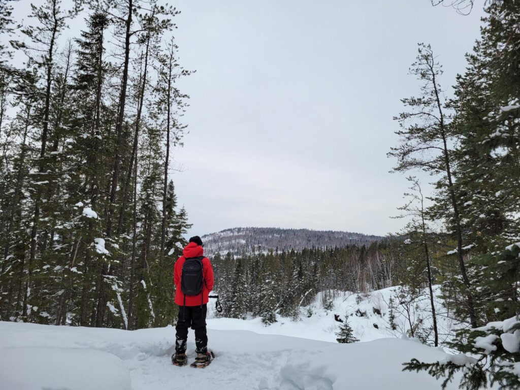
Snowshoeing through Aspen Forests. Twigs and bark from this tree is a winter staple for moose.
With our details finalized, our dates booked and our gear packed we are off to Aiguebelle National Park for a winter getaway! We hoped the weather in early February would be kind to us. Gear was carefully catalogued into the Watershed bags and warm clothes and sleeping bags into the Skully bags. The combination of fresh and dehydrated food, along with wine, into a bear barrel. Enough water and small propane canisters to last us for the trek were also stowed away. The bulk was not an issue for us, as we had prearranged a shuttle transport of our gear from cabin to cabin via snowmachine. The only thing we had to concentrate on was the scenery.
From Kingston, it only took a nine-hour drive, ten if you include the stops to stretch our legs and obtain coffee and gas for us to arrive at Aiguebelle National Park. A natural gem of a park located in western Quebec in the Abitibi-Temiscamingue region 50 km north-east of Rouyn-Noranda. Later we discovered the region is the watershed line between the St. Lawrence River and James Bay. The park offers nine rustic shelters and four larger cabins for four-season backcountry accommodations. Depending on the season and location, the rustic shelters are accessible by car, canoe, on foot, backcountry skis or snowshoes.
Here we would backcountry ski and snowshoe to rustic cabins for four nights. The terrain of the park belongs to the Canadian Shield, vaulting steep hills, gorges, dotted with many lakes and streams, surrounded by boreal forests. Highlight this with the abundance of crisp clean snow and we have ideal conditions for our trek with postcard photo views.
During the summer months, a 22-metre high footbridge allows one to cross a gigantic fault if it is not too windy or vertigo is not a problem. The cabins were rustic and small with a slim Coleman tabletop stove to cook with and a small wood stove in the corner, with firewood supplied in abundance. A large pot was available to melt snow for doing dishes. To complete the cabin a small bunk for sleeping. These cabins were quite cosy when illuminated with candles as a light source.
Rustic Cabin, La Cigale with a spectacular view of the valley below!
We chose La Cigale as our first rustic shelter, where the views are stunning. Dawning our snowshoes for the 4 km trek we set out traversing switchbacks to reach the ascent of the final 800m, a climb that made your heart pound with exertion and of course the views. Once at the summit the shelter offers sweeping panoramic views of the lakes below. Here we would stay for two nights while exploring the trails before heading onto our next cabin Le Patineur. Switching to our skis we descended the ridge and braced the cold but bright day to enjoy the scenic forests and undisturbed beauty of the snow-covered lakes along the way to Lake Patrice where our next shelter Le Patineur would await us.
Well marked trails throughout the Park
Snow Machine Transport from cabin to cabin is available.
This cabin was on the shore facing remarkable views of the lake on one side and majestic hills on the other side. We were surprised to find that this cabin was even smaller than the last, approximately 11 x 7 feet. This made it even more challenging to find a location to tuck our gear out of the way. Every spot under the bed and every shelf was filled with our gear. The door of this shelter did not close completely and a draft was present, add this to the -32 Celsius temperature and our water bottles left on the floor froze solid overnight, despite the woodstove blazing all night.
This was certainly a brief but rewarding winter getaway! Filled with great memories, wonderful sights, a few aches and pains, this was truly a wonderful jewel of a park worth the drive to visit!
The Great Bog Monster
Last summer during our canoe trip in the West Spanish Forest, we had the absolute pleasure of meeting Dennis Rogers of Canoehound Adventures and his awesome group of paddle pals. We are tickled pink to be featured in Day 3 of his 7-Day trip video series!
We completed most of the same route Dennis’ group paddled and portaged, but in reverse. We also had the excitement of meeting the ‘Great Bog Monster’!
Backcountry Couples
Michigan backcountry couple, Canadian native Colleen Kuehl and American husband Jonny, have an amazing enthusiasm for paddling, backpacking, camping and overlanding! They also have a YouTube Channel, Kuehl Kuest – ‘Backcountry Couples’ where they chat with other couples that share their enthusiasm! Colleen and Jonny, honeymooners at 50 interviewed us, Carol and Glenn, honeymooners at 60! How fun is that!
Yes, we published a book! Yes, they are selling fast! You can get your copy from any major online book retailer or contact us for your own signed copy!
Welcome to our blog! You have received our blog because you are a subscriber, friend or supporter of Canoe for Change! Email us if you have any questions or comments. We would love to hear from you!
Wilderness Area and Nature Reserve – 100 Wild Islands, Nova Scotia
We had planned to head to Woodland Caribou Provincial Park for a paddling adventure. This outing would have encompassed a 23-hour drive to reach the western edge of Ontario near the Manitoba border. We had to stop and pivot after receiving a telephone call warning us the area was experiencing an above-average number of forest fires, which eventually led to the closure of the park.
Our pivot took us to Eastern Canada, in particular, Nova Scotia along the rugged eastern shore, a mere 15-hour drive for us through Quebec and New Brunswick. The 100 Wild Islands are a little known gem of Crown-owned islands, a short distance east of Halifax. A fascinating paddle route with sand beaches, protected lagoons, seal and seabird colonies, and hidden campsites. This region of the Atlantic Ocean does have exposed areas once you travel beyond the protection of the islands that can be transformed from a quiet sea into a frothy maze of whitecaps in very little time.
We navigated tides and ocean swells, negotiated currents and reflected waves for the next several days. Also, we experienced absolute calm water, warm temperatures and sunny days, including a morning of thick dense fog limiting our vision to only a few metres. After leaving the Coastal Adventures put-in site at Mason Cove, we paddled past Inner Baltee Island toward Baltee Island. The passage between the two islands is shallow water and a soft-shelled clam bed. Just past the eastern opening, we found a crescent-shaped sandy beach, a pleasant place to stay for the night. With warm clean inviting sand, we had the whole beach to ourselves and a small flat grassy area to pitch our tent just beyond the sand.
Tangier Harbour
Moving forward, we paddled around Inner Baltee Island before crossing over Tangier Harbour to find the Carryover Cove that once served as a portage. However, an hour each side of the high tide there is enough water that one can easily canoe or kayak through the cut. It opens to views of vertical sections of cliffs of what is thought to be the oldest rock on earth, the ‘Tangier Dykes’. Tangier Dykes are believed to be parts of the bottom of the earth’s crust that have been broken off and transported by molten lava upward through fissures. The mixture of rock fragments and lava solidified before reaching the surface and subsequent erosion and uplifting have exposed it. What waited for us was a small pocket pristine white sand beach with turquoise water harbouring a campsite. Flanked on either side by these cliffs was a view of several small windswept islands at our front doorstep. A unique spot.
Carryover Cove
The next several days, we witnessed Harbour Seals following our canoe curious about what we were doing. Eagles perched high in the trees keeping watch over their domain, while we viewed salt marshes, unusual for offshore islands. We spotted a deer passing silently as it moved along the edges of the unique boreal rainforest. We listened and watched as the tides changed the shoreline, exposing rocks and shoals only to have them disappear many hours later by crashing waves.
Cap Island, another interesting spot, had a small sand beach where we watched crabs trying to hide among the few rocks. The other side of the island revealed huge whaleback rocks scoured by the ice age, perfect for enjoying a cup of coffee while viewing Stoney Island and Gerard Island and the sea beyond. During the night we were listening to a symphony of sounds. A calliope of bellowing seals, screaming eagles, the chatter of what we assumed were otters, due to the amount of discarded crab shells and the rusty moaning of a distant unseen navigation buoy. To add to the mix was the occasional snoring and crashing wave, all of which kept us quite amused.
During our 2017 cross-Canada canoe trip we camped on Chapel Island and wanted to revisit the Potlotek First Nations community while we were in Nova Scotia. Since then, the community has built Potlotek Greenhouse, which encompasses a greenhouse, geothermal climate battery and a sustainable in-ground heating system. Here they are growing a huge variety of produce all year round from herbs to kale and watermelons! Besides planting, harvesting and selling their produce, they were busy at work getting ready to greet school students that were going to learn how to grow their own vegetables by planting bean seeds. It’s great to see sustainability and food security at work here by these young people! Way to go!
Tuesday, October 19th is the date! We are honoured to be a guest on the Canoehound Adventure Show! Be sure to tune in to YouTube at 7 pm!
Dennis Rogers interviews outdoor enthusiasts live every Tuesday where viewers can learn more about the great outdoors!
If you have not already purchased our recently published book or you would like to buy a copy for your family and/or friends, follow this link to our website Canoe for Change.ca
Welcome to our blog! You have received our blog because you are a subscriber, friend or supporter of Canoe for Change! Email us if you have any questions or comments. We would love to hear from you!
Off to the Spanish Forest region, northwest of Sudbury, Ontario! The weather forecast at home was once again calling for hot humid weather – what better time to get outdoors and on the water!
The trip would take us ten days and cover approximately one hundred kilometres. The route was taken from Kevin Callan’s book ‘Top 60 Canoe Routes of Ontario’. The author did a slight variation of this route due to low water levels he experienced that season; lack of water made it difficult for him to navigate and travel on many of the creeks that lay ahead and caused him to deviate from the original plan. For us the water levels were way up and things looked promising. We planned to complete the entire loop including a day of leisure as time allowed.
Starting at Biscotasing General Store looping south down Biscotasing Lake with its many islands into Indian Lake and Mozhabong Lake where the waters are emerald green and clear. We crossed over to Sinaminda Lake and headed north through the narrow openings of Sinaminda Creek. The region encompases one of the worlds largest old-growth forests consisting of large Red and White Pine trees that cover the spectacular steep rocky shores along the lake. Making our way into Alton Lake, Winnie Lake and Mishap Creek then into Houghton Lake following the lake as it runs parallel to railway tracks before flowing under the rail line.
Houghton Lake Railway Tunnel
Throw in the unmaintained portage or sometimes a missing or non-existent portage; an old snowmobile trail claiming to be a portage then add some marshy and mucky footing on the trails and all in all it was a great trip. One portage worth mentioning was a 700-metre trek through a swamp. In the pouring rain and burdened down with heavy packs we slogged up to our ankles in water following a moose track along a trickle of water through a peat-like bog.
Mozhabong to Dusty Lake Portage – nothing glamorous about this!Attempting to locate a non-existent portage on Sinaminda Creek
Hot and hazy weather, frequent rain showers followed us for the first several days complete with a violent thunderstorm that caught us completely off guard just as we were trying to enjoy dinner one evening. We had arrived at Alton Lake mid-afternoon and spent the next hour searching for a spot to establish camp. With recent wind damage, some sites were non-existent with tree blowdown or overgrown from lack of use. We located the only site we could find, along the narrow arm opening of the west branch of Alton Lake and set up camp erecting tarps in preparation for another evening of rain.
A few days ago we met a great bunch of guys – a group of six paddlers including Dennis Rogers, the YouTube producer and celebrity of ‘Canoehound Adventures’. They had entered the Spanish Forest region from the south and were doing a variation of the route in reverse. We expected to cross paths later in the trip as they headed back south and we headed north. With our dinner prepared and almost ready to consume, a hot blowing wind from the south suddenly switched and started blowing from the north. With this sudden change, we heard an incredibly loud noise which caused us to look up at the narrow opening of the lake to witness a wall of rain bearing down on us. Seconds later the rain hit us like a wave, our canoe which we secured to a tree, was forced tight by the wind against two trees behind it. The rain continued to come in sheets, causing white caps to appear on the lake, and in fifteen minutes it reduced itself to steady rainfall. We quickly cleaned the meal dishes and retired into the shelter of our tent. About an hour later, with darkness approaching, we heard voices, and the group of six were making their way down the lake. They looked exhausted and soaking wet. It turned out they had been paddling and portaging for eleven hours and were on the water at the time the storm hit. It took little convincing on our part to offer and share our small site. They quickly assembled their tents and changed into drier clothes. We assisted by boiling a large pot of water and the group had a quick meal of hot soup. Sleep came easy for them that night. The next morning, while enjoying freshly brewed coffee, we shared stories, route logistics and spoke of our common love of this wild land.
Comradery in the wilderness is a great connection and we hope for a lasting friendship. Yes, the best trips are not without challenges and the easy uneventful trips sometimes one does not remember.
Dennis, Jay, Owen Glenn, Rick, Seth, Nash and 2 pooches behind the scenes, Wiley and Mollie
Check out Canoehound Adventures!
Canoehound Adventures is a website for people interested in canoeing, camping, bushcrafting and the great outdoors. Dennis Rogers has some really great videos you can check out on his popular YouTube Channel!
Chili – A Favourite Backcountry Camp Recipe!
Get the chill out of your bones on a rainy day with an easy to make Chili con carne recipe! With all dehydrated ingredients prepared at home, the meal is ideal to whip up for one of those challenging days in the wilderness when you are too tired to do a lot of meal preparation.
water – approximately 4 cups (909 mL)
1/4 cup (57 mL) red quinoa
1/3 cup (76 mL) of the folllowing dehydrated ingredients: red kidney beans, chickpeas, brown beans, black beans, corn, mushrooms, sweet peppers
1/3 cup (76 mL) dehydrated tomato leather
Pinch of red pepper flakes
1 tbsp (15 mL) of chili pepper
1 tsp (5 mL) each of salt and pepper
1 tsp (5 mL) of garlic
TVP, ground beef, or dried sausage (optional)
At camp boil the quinoa for 7 minutes. Add the rest of the ingredients bring to a boil and let rest for 20 minutes or longer. Serves 4.
Tip: To save precious fuel, food is cooked in a pot until it reaches boiling point and then the heat source is removed. The pot is placed in a Hot Pot Cookware Insulator (much like a tea cosy) leaving the food to cook/steam itself to perfection!
Check out more of our backcountry camp recipes here!
Canoe for Change: A Journey Across Canada
If you have not already purchased a copy of our recently published book or you would like to buy a copy for your family and/or friends, follow this link to our website Canoe for Change.ca
Welcome to our blog! You have received our blog because you are a subscriber, friend or supporter of Canoe for Change! Email us if you have any questions or comments. We would love to hear from you!