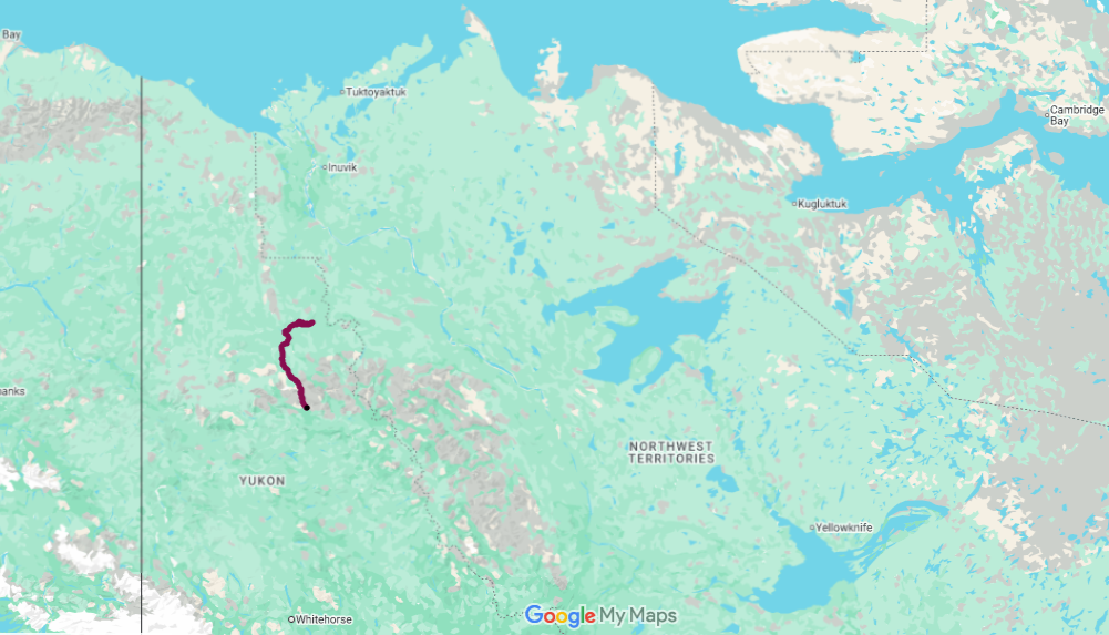
Big open skies, crisp, clean air, and visions of paddling between mountain ranges lured us back to the Yukon—a land “Larger than Life.” We returned to Canada’s true North to paddle the Wind River.
The trip began with a floatplane ride from Mayo with Alkan Air to McClusky Lake, deep in the remote Peel River Watershed. The paddling in this area is remote, with no road access. The only way out is to complete the journey—or, in the case of extreme emergency, evacuate by helicopter. We arranged in advance to be picked up by floatplane after 18 days at Taco Bar on the Peel River, just south of the Arctic Circle. The floatplane would fly us back to Mayo and conclude the journey.
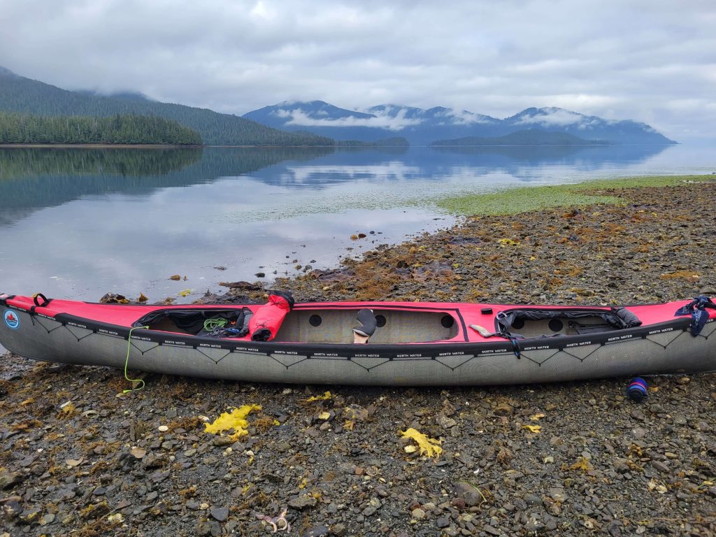
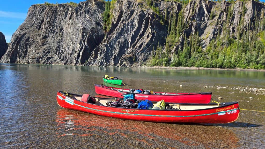
The drive from Whitehorse to Mayo was a short five-hour trip. Upon arriving at the base, paddlers have their equipment weighed before loading; the weight is added into a calculation determining the amount of fuel allotted for the flight. Carol and I were given a bypass on the weigh scales due to the minimal amount of equipment we were packing. With gear loaded and the canoe securely fastened to the plane’s exterior float, we were flown to McClusky Lake.
From McClusky Lake it was a short portage to a creek that flowed into the Wind River. The creek turned out to be shallow, and we mostly walked and dragged the canoe down its length. To finish the first day, we made camp at the confluence of the creek and the Wind River. From there we tried to locate a long-forgotten trail to a hot spring, but after several hours of hiking the trail diminished, leaving us with a vast area and little information on how to continue.
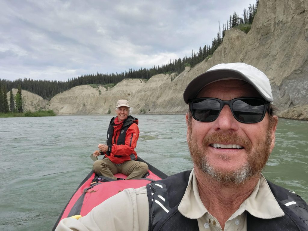
We continued down the Wind River, its crystal waters carving a path through the Wernecke Mountains. These rugged peaks guarded our journey as we followed the river north. The next week or two were intended to be a relaxing, leisurely paddle, with days spent navigating the river and frequent stops to hike the mountains and take in the vistas. We were impressed with the river’s clear, cold water, which allowed us to peer into its depths. The current was swift and branched into many braids—multiple channels requiring constant attention, with blind corners that held the possibility of fallen sweepers or logjams. The day’s travel was at times mentally fatiguing and physically tiring.
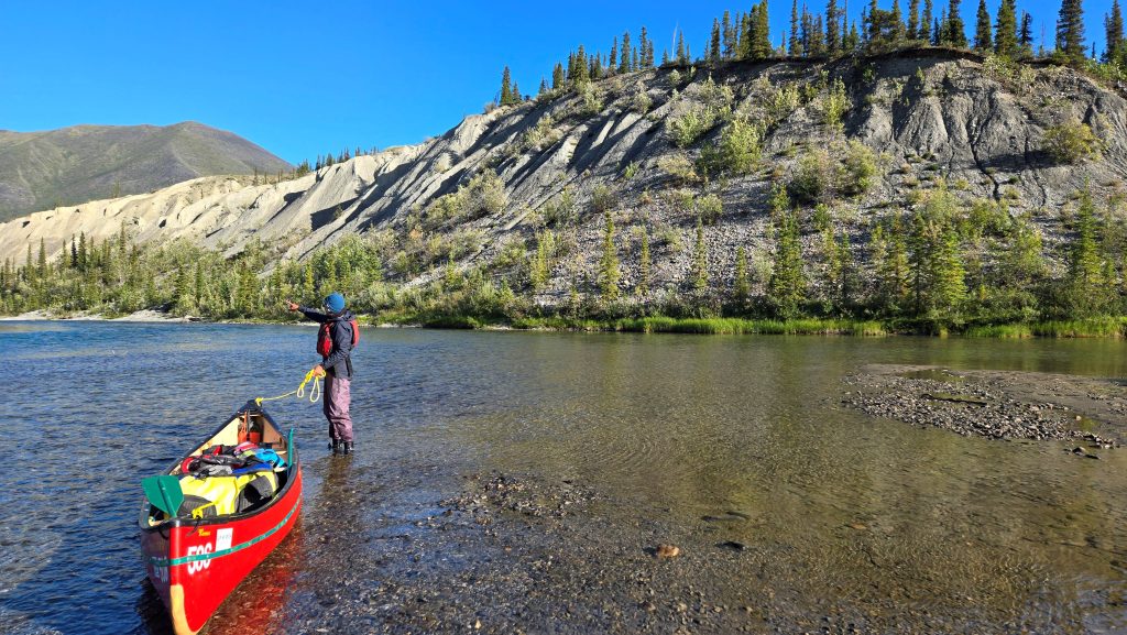
Paddling while keeping a constant eye on the river and its obstacles left little time to gaze at the beautiful scenery beyond. Quick glances were cast toward the mountains, searching for Dall sheep and eagles perched atop treetops. Early in the trip, we stole a lingering glance at something on the shore that seemed out of place, instead of focusing on the river ahead. That distraction caused us to broadside a sweeper in the water, flipping the canoe. Several of our items continued downriver without us. It was a sudden wake-up call: if we did not pay closer attention to navigating and scouting sweeping corners, this river would consume us and spit us out—cold, wet, and frustrated.
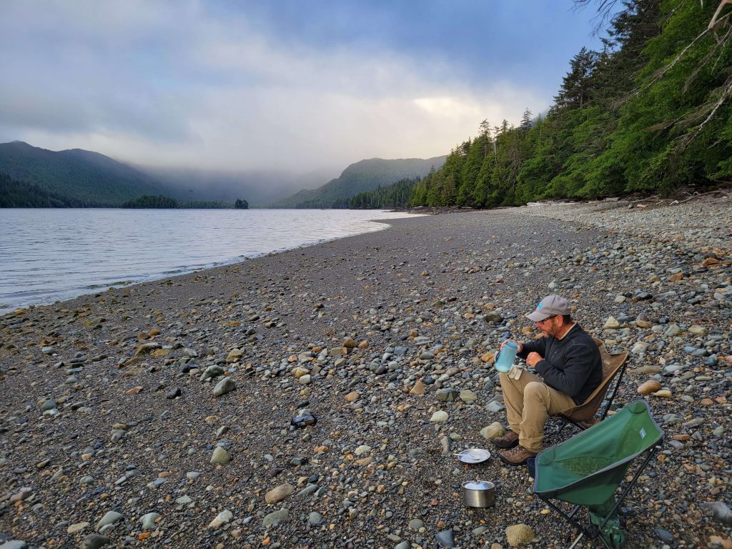
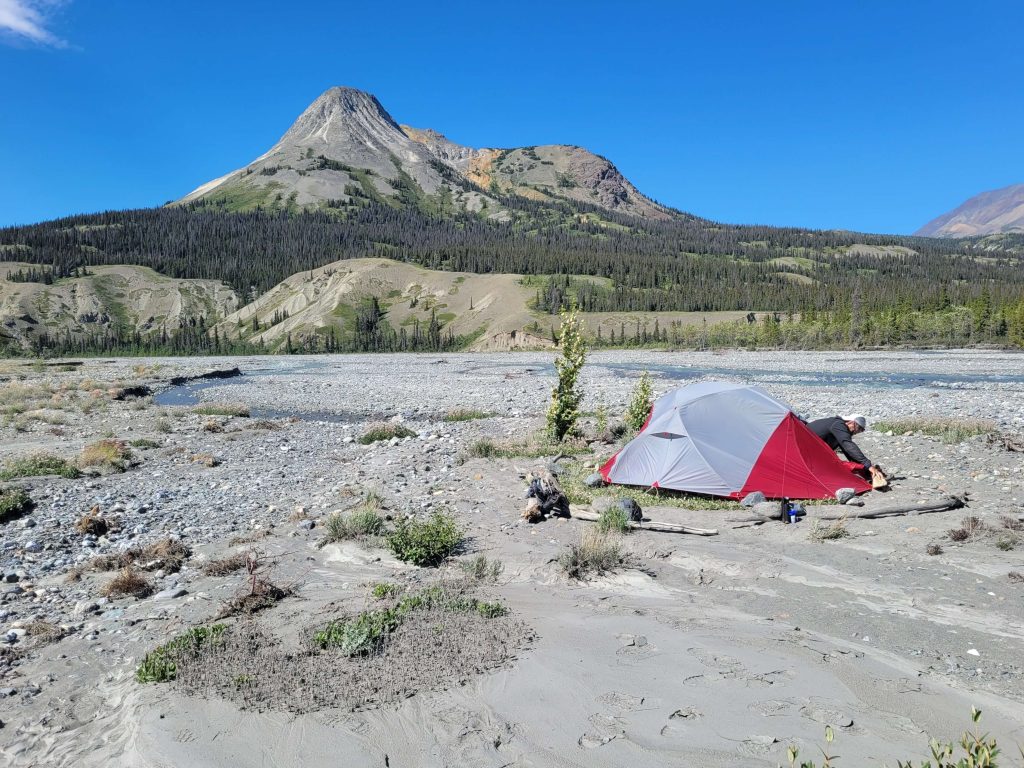
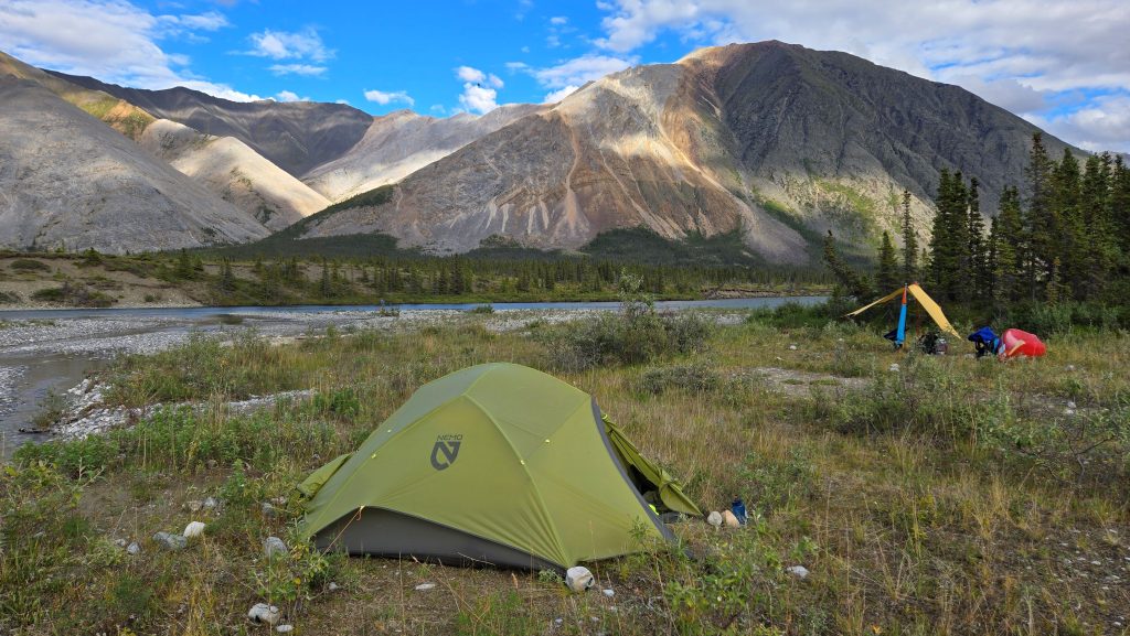
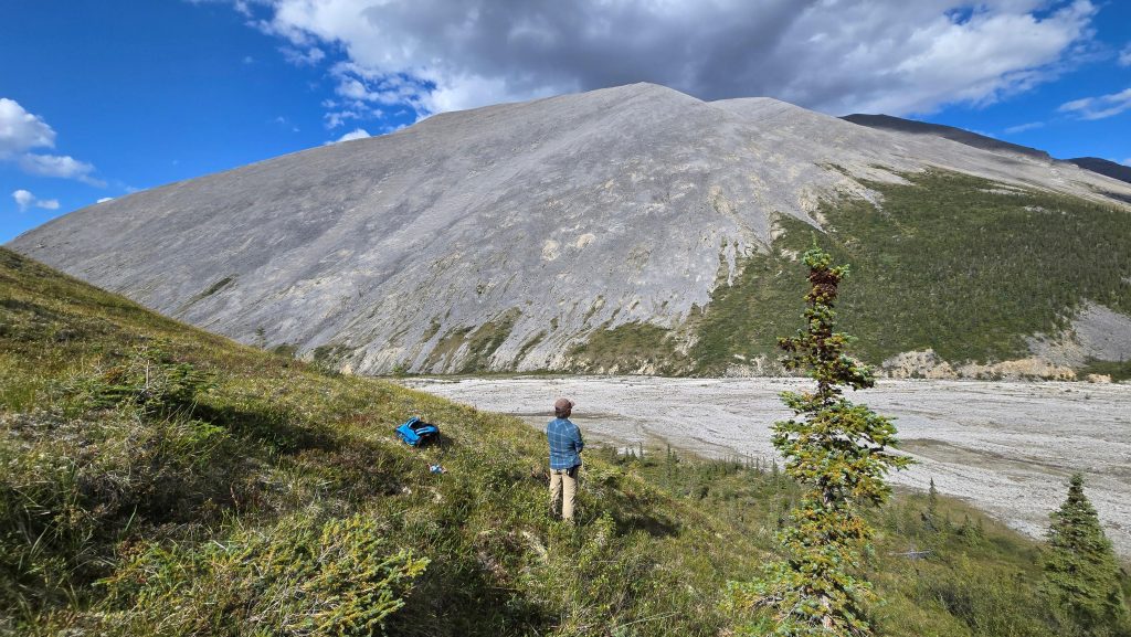
Our days on the river were short, as we intended to make optimum use of our time hiking to scenic vistas atop the mountains. These were sometimes easy to reach from the alluvial fans at the base of the slopes. We camped at these locations and spent the following day climbing toward the peaks. From the mountain ridges, views of the river as it snaked and carved its way through the valley were remarkable—almost beyond what a photograph could capture. So we simply sat, relaxed, and drank in the beauty of it all.

After challenging hikes to the summits, the notion of placing our heads on our pillows felt extremely rewarding. One misty morning, during our ritual of sitting quietly with hot coffee, we observed two caribou racing for their lives across the cobblestones of an alluvial fan. They ran fast toward a large burnt forest, trying to escape a lone white wolf in pursuit. The beast travelled like a ghost, eating up the distance in long, measured strides. We cheered for the caribou to move faster as they disappeared from sight. Then we realized this was the circle of life in the far North—each must struggle to survive.
Moose and bears were also sighted, along with many ducks and eagles. The wildlife here was abundant and thriving, and to see so many animals along the river in such a vast area was enlightening.
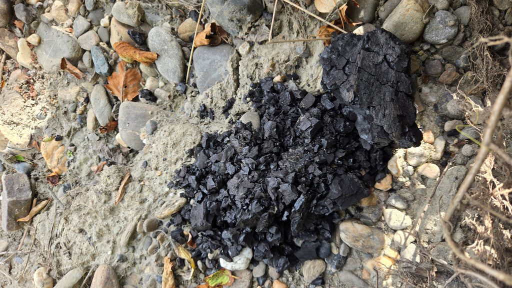
From the confluence of the Wind and Peel Rivers, the river opened wide. Gravel bars stretched across the current, and the distant mountains faded into the horizon. Steep banks of unconsolidated sediments rather than solid bedrock met us as we paddled northward. We saw deposits of coal along the riverbanks. Paddling downriver, we noticed the odour of burning, and much to our amazement, rising starkly from the riverbank, we spotted a cliff smouldering—dark coal seams sending smoke into the sky. It was a reminder that even here the earth itself was alive.
The further north we traveled, the more the weather changed. We felt privileged to experience the remoteness of one of North America’s last great wild watersheds. The rolling tundra and open plains stretched before us. Vegetation thinned—spruce and willow gave way to open ground, emphasizing the vastness of the Peel Basin. Weather grew more threatening, with looming rain and cooler temperatures more frequent. This was especially evident after passing through the Peel Canyon region. The canyon was gorgeous, with steep, narrow walls carved into the rock. We could not resist camping on a sizable cobble beach within the canyon itself. The views from inside were amazing—shadows played with the sun, and the cliff walls seemed to change every few minutes. Sudden winds picked up sand from the cliffs and hurled it down the canyon, forcing us to anchor the tent with large rocks to prevent it from tumbling away.
From the canyon to Taco Bar, the winds continued to gust suddenly without warning. Rain began, propelled by the wind, and it felt cold. One morning, while preparing to take down our securely anchored shelter, a fierce gust rushed down between the canyon walls and caught us off guard. We scrambled to disassemble and drop our tarp for fear it would tear. Even our canoe, far up on shore and weighed down with large rocks, threatened to topple away. We sheltered in place as blowing sand and dust pelted us. When the wind diminished, the rain approached, and we decided to continue toward Taco Bar in the downpour. There we signalled our floatplane via our Garmin device, informing them we were in position to be picked up the following day—pending a visibility report in the morning.
We were anxious the next morning, packed and awaiting the arrival of our flight. During the wait we sipped coffee and watched a large bear saunter down the shoreline beneath the cliff opposite Taco Bar’s cobble beach. As the plane approached and landed, we were impressed with the pilot’s skill, and it was clear why this was the only possible place to land. After a flyover to ensure the river was clear of debris, the pilot banked sharply away from the sheer cliff, dropping altitude quickly as the plane skimmed the water’s surface and floated toward us.
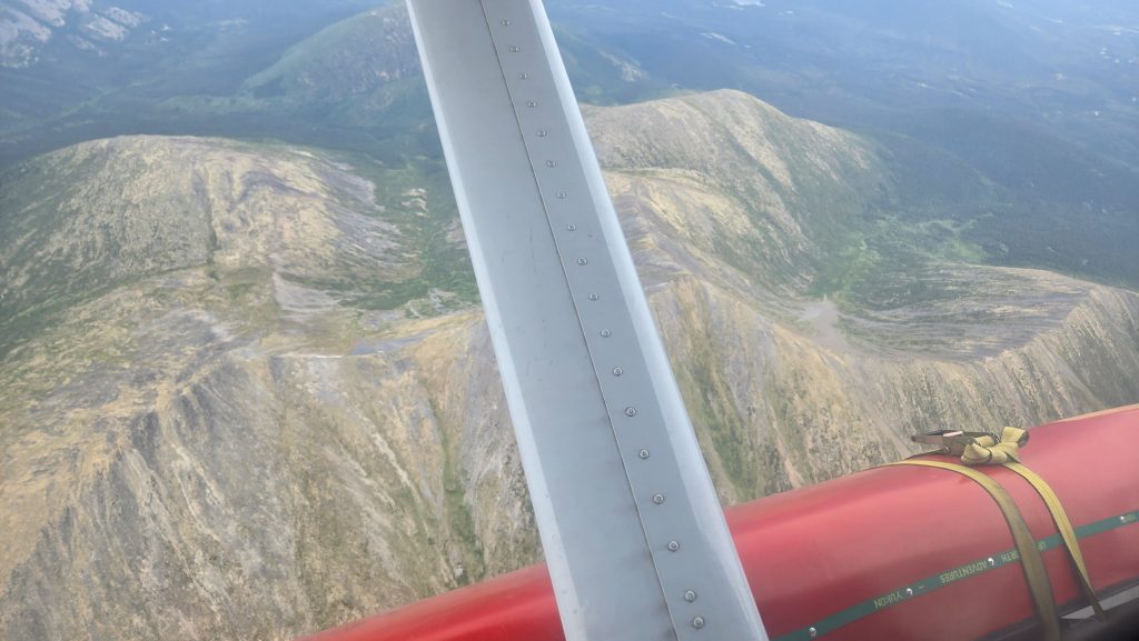
The flight back to Mayo could not have been more spectacular—a perfect day for flying, with clear blue skies and no turbulence. We were in awe of the sights: winding rivers and vast land stretching as far as the eye could see. Best of all were the mountain ranges we flew through—the Knorr Range, the Rackla Range, and others that make up the Wernecke Mountains. These mountains seemed to vault into the sky, each peak dramatic and rugged. The plane felt close to them, though it was only an illusion created by their enormous size. From this vantage point, we could see how the rivers were fed by snowmelt high in the mountains, the water winding down through valleys toward the Peel Watershed, ultimately the Peel River, the Mackenzie River, and eventually emptying in the Beaufort Sea.
The Yukon’s vastness, its silence, and its untamed beauty are what call us back—and this trip reminded us why.